

Wind Ports and Sea

Wind Ports and Sea의 설명
“Wind, Ports and Sea” is an EU project developed as part of the Italy-France “Maritime” Cross-border Cooperation Programme 2007-2013 (Liguria, Tuscany, Sardinia and Corsica) and financed by the European Regional Development Fund (ERDF).
It represents the continuation and development of the “Wind and Ports” Project (2009 – 2012) which installed wind monitoring systems and mathematical-statistical calculation models at ports on the Northern Tyrrhenian Sea - Genoa, Savona, La Spezia, Livorno and Bastia - that could provide stakeholders with information on mid-range (12-24 hours) and short-range (1 hour) wind forecasts through a WebGIS system display.
At the end of the “Wind and Ports” Project, given the excellent results achieved and encouraged by the great response and satisfaction from the stakeholders, the whole partnership decided to step up its efforts to develop a new project that would further improve accessibility to port areas and help carry out any related port operations.
Indeed, the “Wind, Ports and Sea” project arose from requests made by stakeholders (in particular, port authorities, pilots, tugboat operators and linesmen) during the local Auditing Groups of the previous project, asking for help increasing safety for operations linked to shipping access to ports.
In a nutshell, the project involves extending the wind forecasting system to the stretch of water in front of the ports, enhancing the previously set up monitoring networks with new high-tech instruments, and developing a new forecasting system for sea and weather conditions based on the implementation of combined wind-wave models, so they would effectively take into account the existing interaction between these two natural wonders.
To encourage the implementation and confirmation of new best practices, the decision was made to develop a pilot activity at the port of La Spezia aimed at measuring waves indirectly through a ground-based seismometer system. The measurements achieved, combined with those from the wave buoys in the Northern Tyrrhenian Sea, will help provide real-time monitoring of wave parameters and will be used to validate the wave forecasting system.
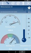
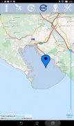
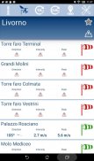
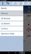
The system developed by the “Wind, Ports and Sea” project is continuing the objectives set by its parent project, providing the port communities with a wind and wave study of the areas concerned, which aims to create a new forecasting WebGIS and a smartphone app to remotely display sea and weather measurements and forecasts.
Last but not least, it is worth noting that the “Wind, Ports and Sea” project can make a very significant contribution to the study of the coastal system, which is extremely important for the maintenance of existing port facilities and for any future maritime projects that certainly cannot leave out direct assessments of the coastal area’s oceanographic parameters.
We would like to thank the European Union for its funding, the Joint Technical Secretariat of Tuscany and the Single Managing Authority of Tuscany for their continued support, as well as all the organisations, businesses, companies, trade unions and everyone else who has contributed in any capacity to creating this wonderful project.
---
You need username and password to request to the port authorities:
http://webgis.ventoeporti.net/ventoportiemare/home_page/index_en.php#contact


